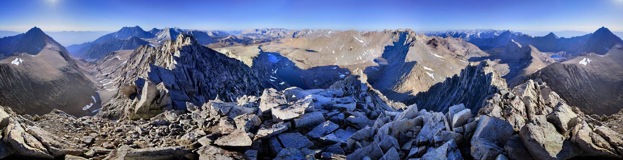
Junction Peak Panorama - Sierra
360 panorama looking SW from Junction Peak, w/ left to right, Junction Pass, Mt Keith, Shepherd Creek Drainage, Mt Williamson, Mt Tyndall, Junction peak SE ridge, Rockwell Pass, the Tyndall Creek drainage leading directly away SW into Kern Canyon, nearer from that the flat sunlit elevated plateau of Diamond Mesa, at center midground in shadow the upper Tyndall Creek headwaters Basin and route of the JMT, Caltech Peak, at center right the V notch of Forester Pass in shadow on the left/S side, and sunlit but mostly hidden on the right/N side, the NW Junction Peak ridge leading to it, the Bubbs Creek drainage and route of the JMT leading directly away N, flanked on the left by East Vidette Peak and on the right by Center Peak, the long Center Peak S ridgeline and route of Junction Pass Trail pointing directly to Junction Peak, Center Basin, Junction Pass and it's sunlit large flattish sloping mesa at far right and far left. Off the John Muir Trail near Mile 193.