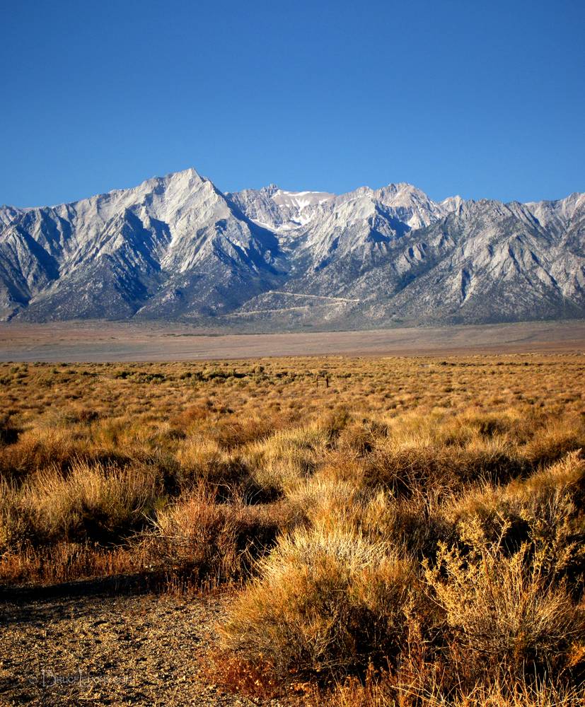
Whitney Portal Road from Independence
Whitney portal Road, the exit point for the John Muir Trail, viewed from Independence. Because Mt Whitney is set back 4 miles or so from the foreground peaks, it is hidden behind them. It actually would be slightly to the right of frame. Whitney Portal Road is visible switchbacking up into the valley, which runs across behind the forested ridge at the top of the last visible switchback. Mt Whitney, at 14,505 ft, is the highest peak in the contiguous United States. The 7 mile or so hike from Whitney Portal to the Summit is a very aggressive day hike of 11 hours or so up and back, more comfortably done as a 2 day hike. The JMT comes from the backside to summit Mt Whitney. California, Sierra Nevada Mountains, Owens Valley, Independence. Off the John Muir Trail near Mile 220.