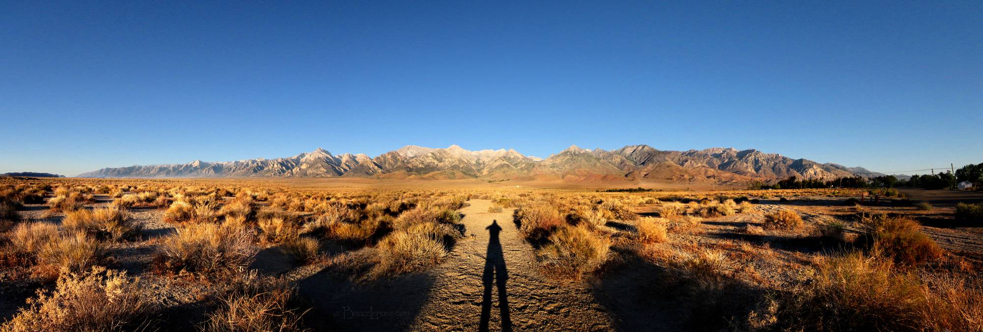
Eastern Sierra Crest from Independence
Looking W at the Eastern Sierra Crest on the Southern end of the Sierra Nevada Mountain range in east central California, and endpoint of the 220 mile John Muir Trail at Whitney Portal, below Mt Whitney, the highest peak in the lower 48 states. Onion Valley/Kearsarge Pass is the low saddle just to right of center. Mt Whitney Portal is at the last pointy little white peak to far left. Mt Whitney, deeper behind the lower front peaks, is hidden behind. The high pointy peak at mid left is Mt Williamson. Approximately 10 miles East of the Onion Valley and Mt Whitney Portal trailheads respectively are Independence, (from which this photo was taken), and Lone Pine, 15 miles apart on hwy 395. California, Sierra Nevada Mountains, Owens Valley, Independence. Off the John Muir Trail near Mile 220.