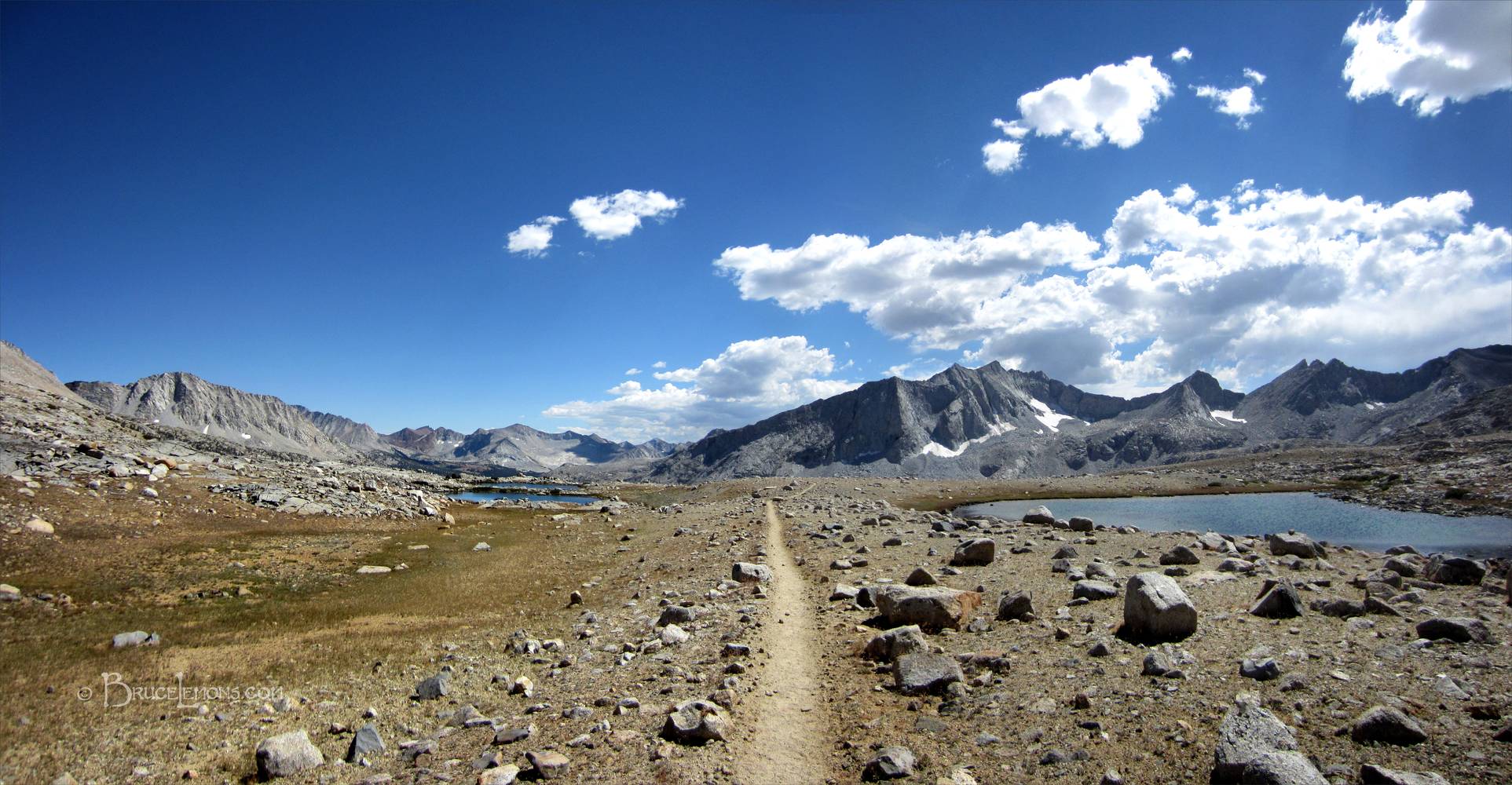
Upper Basin - John Muir Trail
Heading South. Mather Pass is a mile and a half behind, and Pinchot Pass is 8 miles ahead, just barely hidden around the corner of the ridge immediately to the right of the pointy chocolate colored peak (Crater Mtn) left of center. The trail drops down into the upper Kings South Fork Valley at mile 157 of the JMT before rising again towards Pinchot. The highest point from this perspective, at center right, is Venacher Needle, with Mt Ruskin (maybe) just barely barely peaking it's point out behind the ridge going down from the left of the Needle. California, Sierra Nevada Mountains, Kings Canyon National Park, Upper Basin. John Muir Trail Mile 153.