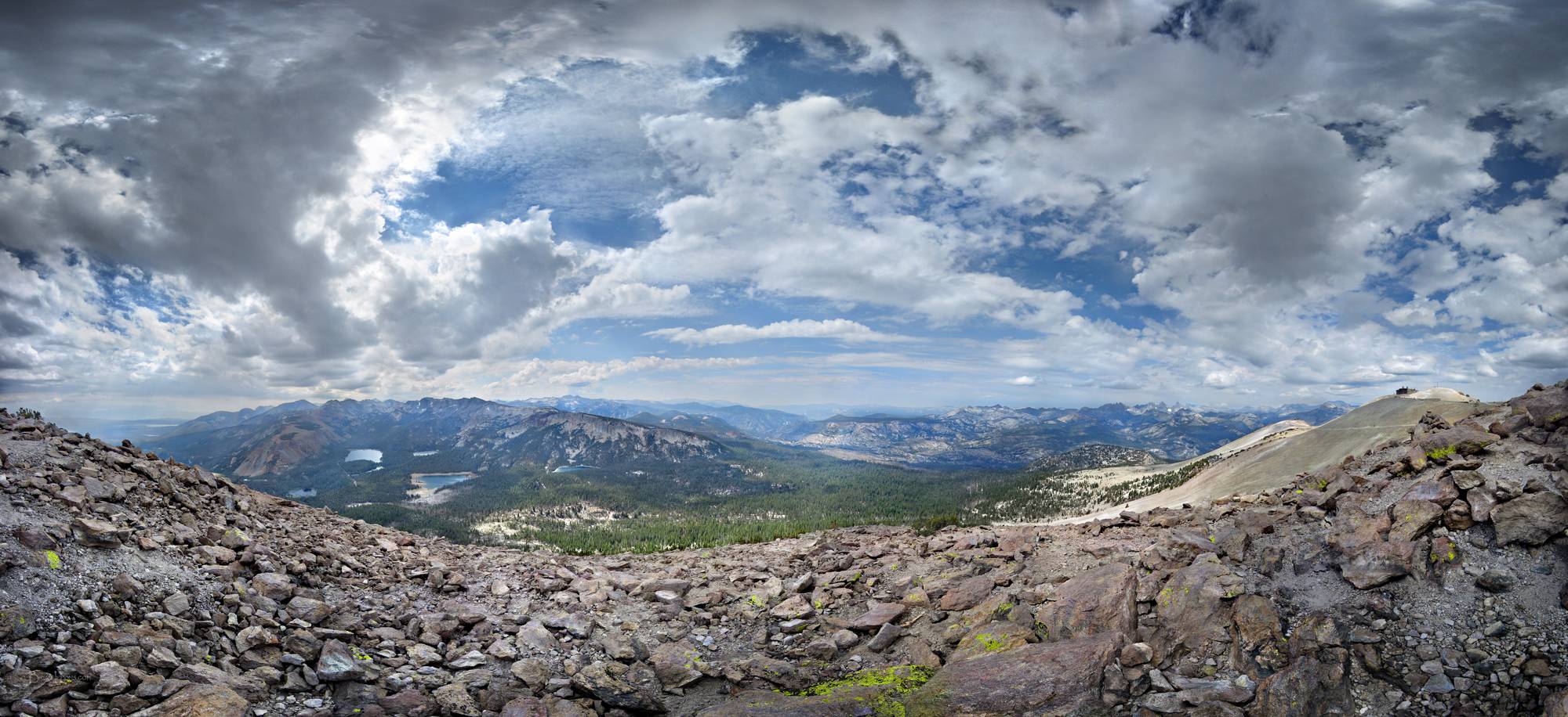
Mammoth Mountain Panorama - Sierra
Panorama looking SE to NW from near the top of Mammoth Mountain. Left to right is the town of Mammoth Lakes mostly hidden behind the ridge, Lake Crowley in the far distance, Red Peak, Mammoth Lakes Basin with Upper Twin Lakes, Lake Mary, Lake Mamie below it, Horseshoe Lake with the deep shoreline where trees have died from natural release of underground CO2 in the last few decades, Mammoth Crest behind, McLeod Lake (sometimes called McLoud Lake), Mammoth Pass in the foreground, the two Red Cones barely visible just left of mid center, the still open area of the 1992 Rainbow Fire mid center, Reds Meadow and Devils Postpile National Monument in the dark green low area mid center, Iron Mountain behind, the Minarets up the jagged Ritter Range farther right, with Mt Ritter then Banner Peak the two prominent peaks horizon center right, Donahue Pass, Donahue Peak, the Koip Crest, San Joaquin Mountain closer far right, and the top of Mammoth Mountain and it's upper ski lodge farthest right. The San Joaquin Valley runs straight SE towards camera at right, and is largely hidden form view behind the lower ridges of Mammoth Mountain, before turning straight S right to left. The John Muir Trail runs from Donahue Pass south paralell and just up ridge West of San Joaquin Valley before dipping down into the valley and Devils Postpile, then up through the Rainbow Fire area and on between the Red Cones. California, Sierra Nevada Mountains, Ansel Adams Wilderness. John Muir Trail near Mile 063.